
South Platte River Virtual Fly Fishing Field Guide
+ South Platte River Fly Fishing Field Guide
GENERAL INFORMATION
Coalition for the Upper South Platte
Colorado Parks and Wildlife (License, Regulations)
Colorado Parks and Wildlife (Fishing Maps)
ABOVE SPINNEY RESERVOIR / DREAM STREAM FLY FISHING
-Nearest Town
Hartsel
-Water Flow
Badger Basin - Above Spinney Res.
Charlie Meyers SWA - Above Eleven Mile Res.
-State Wildlife Areas / River Access
ELEVEN MILE CANYON FLY FISHING
-Nearest Town
-Water Flow
TARRYAL CREEK FLY FISHING
-Nearest Town
Jefferson
-Water Flow
Tarryall Creek Near Como & 285
- State Wildlife Area Locations
CHEESMAN CANYON / WATERTON CANYON
-Nearest Town
Deckers
-Weather
-Water Flow
NORTH FORK OF THE SOUTH PLATTE
-Nearest Town
Shawnee
-Weather
-Water Flow
FLY FISHING SHOPS AND AREA RESOURCES
FLY FISHING SHOPS AND GUIDES BUSINESS PHONE ADDRESS CITY ZIP Anglers All 303.730.8932 5211 S. Santa Fe Dr. Littleton 80120 Virtual FlyBox
Like having an inexpensive
guide in your pocket but
you tie the knots.303.674.2726 7002 S. Silverhorn Dr. Evergreen 80439 Alpine Angling Fly Shop 970.963.9245 995 Cowen Dr. Carbondale 81623 Angler's Covey 719.471.2984 295 S. 21st St. Colorado Springs 80904 Blue Quill Angler 303.674.4700 1532 Bergen Parkway Evergreen 80439 Breckenridge Outfitters 970.453.4135 100 North Main Street Breckenridge 80424 Charlie's FlyBox 303.403.8880 7513 Grandview Ave. Arvada 80002 Cutthroat Anglers 970.262.2878 400 Blue River Pkwy Silverthorne 80498 Denver Angler 303.403.4512 6870 S. Yosemite St. Centennial 80112 Flies & Lies 303.647.2237 8570 S. Platte River Rd. Sedalia 80135 Golden River Sports 303.215.9386 806 Washington Ave. Golden 80401 Mountain Angler 970.453.4665 311 S Main St. Breckenridge 80424 Peak Fly Shop 719.687.9122 301 East Highway 24 Woodland Park 80863 South Platte Fly Shop 719.686.8990 405 E. Highway 24 Woodland Park 80863 Minturn Anglers 855.311.0245 102 B Main Street Minturn 81645 RESTAURANTS AND SERVICES BUSINESS PHONE ADDRESS CITY ZIP Chaparral Park General Store 719.836.0308 19015 County Rd 59 Hartsel 80449 Safeway 719.686.1836 1101 E. US Highway 24 Woodland Park 80863 LODGING BUSINESS PHONE ADDRESS CITY ZIP Flies & Lies 303.647.2237 8570 S. Platte River Rd. Sedalia 80135 + South Platte River Facts
FACTS ABOUT THE SOUTH PLATTE DRAINAGE
The river is formed in Park County, Colorado, southwest of Denver in the South Park grassland basin by the confluence of the South Fork and Middle Fork, approximately 15 miles (24 km) southeast of Fairplay. Both forks rise along the eastern flank of the Mosquito Range, on the western side of South Park, which is drained by the tributaries at the headwaters of the river. From South Park, it passes through 50 miles (80 km) of the Platte Canyon and its lower section, Waterton Canyon. Here, it is joined by the North Fork before emerging from the foothills southwest of the Denver suburb of Littleton. At Littleton, the river is impounded to form Chatfield Reservoir, a major source of drinking water for the Denver Metropolitan Area.
In an arid region of the United States, the South Platte is marked with several dams. The first notable water impoundment on the South Platte is Antero Reservoir. "Antero" is derived from the Spanish word "first,"[citation needed] as it was the first dam on the South Platte River near the river's origin.
The next dam is Spinney Mountain Reservoir. At capacity Spinney Mountain covers 2,500 acres (10 km2). A bottom release dam, Spinney releases to the east of the inlet.
Two miles below Spinney Mountain Reservoir, the river enters Eleven Mile Reservoir, with a capacity of 97,000 acre feet (120,000,000 m3). The Eleven Mile Reservoir Dam drains into Eleven Mile Canyon, which runs through Forest Service land. Under the reservoir are three former Colorado towns, Howbert, Idlewild, and Freshwater Station, which were submerged to meet the water needs of Denver.[5]
From Eleven Mile Canyon, the South Platte runs northeast to Cheesman Reservoir, named for Denver water pioneer Walter S. Cheesman. At its completion in 1905, the dam was the world’s tallest, at 221 feet (67 m) above the streambed. The reservoir and related facilities were purchased in November 1918 by the Denver Water Board. Cheesman was the first reservoir of Denver's mountain storage facilities and has been designated a National Historic Civil Engineering Landmark. Cheesman Reservoir feeds Cheesman Canyon. Six miles below Cheesman Reservoir is the town of Deckers; there, the river bends north for approximately 17 miles (27 km) to the confluence with the North Fork of the South Platte.
From the confluence, the river flows towards Denver and enters Strontia Springs Reservoir.
Below Strontia Springs the South Platte runs through Waterton Canyon before entering Chatfield Reservoir. Chatfield marks the seventh and final dam on the South Platte until it merges with the North Platte.
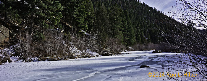
The South Platte River is a Gold Medal Western trout river on the Eastern Slope of Colorado. The river is well known for its wild trophy population of Brown Trout and Rainbow Trout. As a result of the close proximity to Denver, the river sees thousands of fly fishing enthusiasts each year. With seven dams on the river, the South Platte is considered a tailwater fishery. Most of these dams are bottom released which allow for both stable water temperatures throughout the year, and year round fly fishing. Popular fly fishing stretches of the river include Waterton Canyon, Deckers, Cheesman Canyon and the Dream Stream.
Used with permission from Wikipedia, South Platte River under the WikiMedia Terms of Use agreement.
+ Google Maps - Deckers Area
View Denver - Waterton Canyon in a larger map+ Google Map - North Fork of the South Platte
+ Google Map - South Park, Colorado
View South Park, CO in a larger map